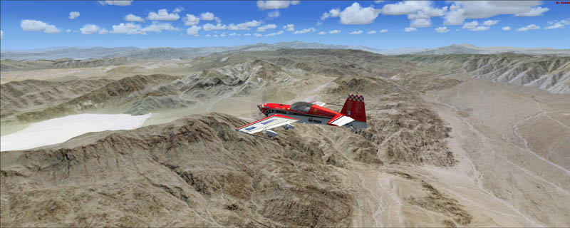
 The ChiliView Series - Death Valley National Park West to Owens Valley The ChiliView Series - Death Valley National Park West to Owens Valley

This region covers the western part of Death Valley National Park. It extends west from Panamint Valley to Owens Valley and brings us very close to the Sierra Nevada mountain range. The airspace above Death Valley is part of the US militarys vast R-2508 Complex Airspace which is composed of several MOAs (Military Operating Areas) and restricted airspaces. The Panamint MOA is part of R-2508 and covers a large portion of Death Valley National Park including the whole Panamint Valley up from 200ft AGL. It is used for high and low altitude mission training by Edwards AFB, China Lake NAWS and Fort Irvin. MOAs are open to the public and do not restrict civilian VFR operations even when they are active. However pilots are encouraged to contact the controlling agency for information on the activity status of the MOA before entering. The controling agency for the R-2508 Complex is Joshua Approach. Furthermore pilots should exercise extreme caution when flying within an active MOA. Southwest of the Panamint Valley lies the restricted airspace R-2505 around the China Lake NAWS. You must not enter restricted airspace without an advance permission from the controlling agency.
It covers a total of 3625 sq km.
For FSX and Prepar3D.
The resolution of 1 m/pix brings you razor-sharp images even near the ground.
Best enjoyed in low and slow operations!
Also contains a 10 m high resolution elevation mesh.
Navigate to neighboring regions:
North
South
East
West
|
!!! BlueSkyScenery needs YOUR help !!!
If you like our sceneries, then please give a little donation.
Your donation makes a difference and helps us to continue this project!
|
Give $1.00:
|
|
|
Give $5.00:
|
|
|
Give $10.00:
|
|
|
Give $20.00:
|
|
Download:
|
FS9 Version:
|
Scenery
|
Airports
|
| |
|
For FSX & P3D:
|
Scenery
|
Airports
|
Scenery Mirror
|
You can support the freeware project by visiting our sponsored links:
|
|
|
All information on this site strictly for simulation use only!
All Trademarks copyrighted. (c) by BlueSkyScenery. All rights reserved.

|
|
|