 The ChiliView Series - Route 66, Part 1: Flagstaff (KFLG), San Francisco Peaks The ChiliView Series - Route 66, Part 1: Flagstaff (KFLG), San Francisco Peaks


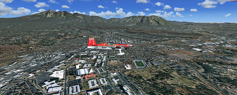
This region covers the area around Flagstaff (KFLG). North of the city you find the San Francisco Peaks. Humphreys Peak is the highest point in Arizona (12633 ft). These mountains once were active volcanoes. North and east of the mountains you can still see dozens of younger craters and lava flows.
I also managed to solve the "airports on sockets" problem of the elevation mesh!
It covers a total of 3625 sq km.
For FSX and Prepar3D.
The resolution of 1 m/pix brings you razor-sharp images even near the ground.
Best enjoyed in low and slow operations!
Also contains a 10 m high resolution elevation mesh.
Navigate to neighboring regions:
North
South
West
|
!!! BlueSkyScenery needs YOUR help !!!
If you like our sceneries, then please give a little donation.
Your donation makes a difference and helps us to continue this project!
|
Give $1.00:
|
|
|
Give $5.00:
|
|
|
Give $10.00:
|
|
|
Give $20.00:
|
|
Download:
|
FS9 Version:
|
Scenery
|
Airports
|
| |
|
For FSX & P3D:
|
Scenery
|
Airports
|
Scenery Mirror
|
You can support the freeware project by visiting our sponsored links:
|
|
|
All information on this site strictly for simulation use only!
All Trademarks copyrighted. (c) by BlueSkyScenery. All rights reserved.

|
|
|