The ChiliView Series - Wind River Range, Part 1: Northwest The ChiliView Series - Wind River Range, Part 1: Northwest
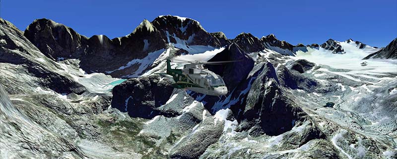
Go on virtual vacation with us! This scenery covers the northwestern part of the Wind River Range, a prominent mountain range in Wyoming. With 13.804 ft Gannett Peak is the highest point in Wyoming. We believe, that this is our best mountain scenery so far. Do what airline captains do in their pasttime. Enjoy nature, fly the backcountry with a light aircraft and leave the FMC at home. There are just two small strips in this package: Haas (2WY3) and Kinky Creek Divide (WY30). Larger airports will follow in upcoming packages. So, bring your small light aircraft for some low and slow flying in this breathtaking mountain scenery!
It covers a total of 3625 sq km.
For FSX and Prepar3D.
The resolution of 1 m/pix brings you razor-sharp images even near the ground.
Best enjoyed in low and slow operations!
Also contains a 10 m high resolution elevation mesh.
Navigate to neighboring regions:
North
South
East
West
|
!!! BlueSkyScenery needs YOUR help !!!
If you like our sceneries, then please give a little donation.
Your donation makes a difference and helps us to continue this project!
|
Give $1.00:
|
|
|
Give $5.00:
|
|
|
Give $10.00:
|
|
|
Give $20.00:
|
|
Download:
|
FS9 Version:
|
Scenery
|
Airports
|
| |
|
For FSX & P3D:
|
Scenery
|
Airports
|
Scenery Mirror
|
You can support the freeware project by visiting our sponsored links:
|
|
|
All information on this site strictly for simulation use only!
All Trademarks copyrighted. (c) by BlueSkyScenery. All rights reserved.

|
|
|