The ChiliView Series - Leadville (KLXV), Mt. Elbert The ChiliView Series - Leadville (KLXV), Mt. Elbert

More screenies:
Prev
Next
Lake County Airport (KLXV), also known as Leadville Airport is the highest airport in the US with an field elevation of 9.934 ft. Because aircraft performance deteriorates rapidly with altitude, many organizations use KLXV for high alitude performance testing. At high altitude airports, the thin air kicks you in every imaginable way. Less engine performance, less lift, less prop efficiency and higher TAS contribute to longer ground rolls during takeoff and landing. Even more so on hot days, when density altitude is even higher. Furthermore, climb rate can get marginal at high altitudes. Therefore it's imperative to check your performance charts before you go. Better reduce your takeoff weight than to impact terrain! When flying in the high mountains, it's a good idea to be back before the heat of the day, when aircaft performance degrades and thunderstorm clouds often begin to build.
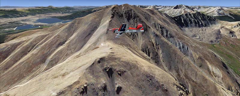
If you fly to the southwest of Leadville you will see Mt. Elbert, which is the highest summit in Colorado (14.440 ft).
The adapted airports for this area are available in the collection of all airports provided by Joop Mak: BSS_AFCADs_0718.zip.
It covers a total of 3625 sq km.
For FSX and Prepar3D.
The resolution of 1 m/pix brings you razor-sharp images even near the ground.
Best enjoyed in low and slow operations!
Navigate to neighboring regions:
North
South
East
West
|
!!! BlueSkyScenery needs YOUR help !!!
If you like our sceneries, then please give a little donation.
Your donation makes a difference and helps us to continue this project!
|
Give $1.00:
|
|
|
Give $5.00:
|
|
|
Give $10.00:
|
|
|
Give $20.00:
|
|
Download:
|
FS9 Version:
|
Scenery
|
Airports
|
| |
|
For FSX & P3D:
|
Scenery
|
Airports
|
Scenery Mirror
|
You can support the freeware project by visiting our sponsored links:
|
|
|
All information on this site strictly for simulation use only!
All Trademarks copyrighted. (c) by BlueSkyScenery. All rights reserved.

|
|
|